APT Basilicata
APT Basilicata
Basilicata turistica
Atella
Info
Distance from Potenza: 39 km
Distance from Matera: 128 km
Altitude: 500 m amsl
Postal code: 85020
Inhabitants: 3699 (Atellani)
Commune in the province of Potenza
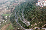
Atella is situated in Vitalba Valley, whose name comes from a mediaeval farmhouse that does no longer exist.
The surrounding area, overlooked by thick woods, and rich in springs, is characterised by luxurious vegetation and lands, where cereals are grown above all.
Founded between 1320 and 1330 by Giovanni d’Anjou in order to populate an area almost abandoned, it became a relevant centre between the XIV and the XV centuries. It was a place of important events and its farming products were sold in the whole region.
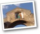
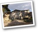
In the mediaeval centre there still are some remains of the walls and the characteristic ‘Porta S. Michele’.
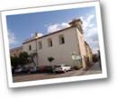
Amongst the several monuments that form the cultural heritage of this village there are the Cathedral of S. Maria ad Nives, the Angevin Tower of a castle destroyed by the earthquake of 1694, S. Lucia’s Church, the Convent, the Benedictine Church and the Paleolithic Park.
Amministrazione Comunale
85020 - Piazza Matteotti, 3
Tel. 0972 716611 - Fax 0972 715889
E-mail: [email protected]
Web: www.comune.atella.pz.it
Pro Loco di Atella "Vitalba"
C.so Papa Giovanni XXIII
85020 - Atella (PZ)
Tel.: 0972 715730 - Fax: 0972 715889
Cell.: 338 8864665
E-mail: [email protected]
ANNO INIZIO ATTIVITA': 1979
POSIZIONE: centro
ORARI: 9:00-12:00 e 16:00-19:00
LINGUE PARLATE: inglese


